


Fresno, California, Hgh State Clinic, Hgh Injections, Hrt Doctors


Fresno, California Blood Testing Facilities
 Represents a LabCorp blood testing facility
 Represents a Quest Diagnostics blood testing facility

Nearby Labcorp Blood Testing facilities:
- Labcorp Center Distance: 1 m, 1350 O Street Suite 101, Fresno, Fresno County, CA, 93721
- Labcorp Center Distance: 2 m, 3004 N Fresno St, Fresno, Fresno County, CA, 93703
- Labcorp Center Distance: 6 m, 1095 E. Warner Ave. Suite 103, Fresno, Fresno County, CA, 93710
- Labcorp Center Distance: 11 m, 2570 Jensen Ave Suite 115, Sanger, Fresno County, CA, 93657
- Labcorp Center Distance: 21 m, 720 E. Almond Ave. Suite 101, Madera, Madera County, CA, 93637
- Labcorp Center Distance: 38 m, 205 S West St. Ste F, Visalia, Tulare County, CA, 93291
- Labcorp Center Distance: 42 m, 1217 N Cherry St, Tulare, Tulare County, CA, 93274
- Labcorp Center Distance: 56 m, 424 E. Yosemite Ave. Suite E, Merced, Merced County, CA, 95340
- Labcorp Center Distance: 61 m, 560 W. Putnam Ave. Suite 1, Porterville, Tulare County, CA, 93257
- Labcorp Center Distance: 63 m, 222 I Street, Los Banos, Merced County, CA, 93635
- Labcorp Center Distance: 72 m, 1206 High Street, Delano, Kern County, CA, 93215
- Labcorp Center Distance: 79 m, 1801 Colorado Ave. Suite 200, Turlock, Stanislaus County, CA, 95382
- Labcorp Center Distance: 90 m, 2120 Golden Hill Rd. Suite 104, Paso Robles, San Luis Obispo County, CA, 93446
- Labcorp Center Distance: 93 m, 1541 Florida Ave. Suite 102, Modesto, Stanislaus County, CA, 95350
- Labcorp Center Distance: 94 m, 133 4Th Street, Gonzales, Monterey County, CA, 93926
- Labcorp Center Distance: 97 m, 350 Posada Ln. Suite 104, Templeton, San Luis Obispo County, CA, 93465
Nearby Quest Blood Testing facilities:
- Quest Center Distance: 0 m, 2841 Tulare St, Fresno, Fresno County, CA, 93721-1320
- Quest Center Distance: 7 m, 3741 W Shaw Ave, Fresno, Fresno County, CA, 93711-3207
- Quest Center Distance: 10 m, 2675 Jensen, Sanger, Fresno County, CA, 93657-9799
- Quest Center Distance: 15 m, 1122 Rose Ave, Selma, Fresno County, CA, 93662-3258
- Quest Center Distance: 16 m, 177 S Madera Ave, Kerman, Fresno County, CA, 93630-1101
- Quest Center Distance: 19 m, 789 N Reed Ave, Reedley, Fresno County, CA, 93654-2434
- Quest Center Distance: 21 m, 363 East Almond Avenue, Madera, Madera County, CA, 93637-5698
- Quest Center Distance: 28 m, 450 Kings County Dr, Hanford, Kings County, CA, 93230-5951
- Quest Center Distance: 36 m, 131 S Tamarack St, Visalia, Tulare County, CA, 93291-6163
- Quest Center Distance: 41 m, 48677 Victoria Ln, Oakhurst, Madera County, CA, 93644-9216
- Quest Center Distance: 43 m, 919 N Blackstone St, Tulare, Tulare County, CA, 93274-7377
- Quest Center Distance: 51 m, 1165 Phelps Avenue, Coalinga, Fresno County, CA, 93210-9665
- Quest Center Distance: 53 m, 5300 Highway 49 N, Mariposa, Mariposa County, CA, 95338-9503
- Quest Center Distance: 56 m, 3377 G Street, Merced, Merced County, CA, 95340-0998
- Quest Center Distance: 64 m, 730 W I St, Los Banos, Merced County, CA, 93635-3421
- Quest Center Distance: 79 m, 777 E Hawkeye Ave, Turlock, Stanislaus County, CA, 95380-7507
- Quest Center Distance: 87 m, 2531 E Whitmore Ave, Ceres, Stanislaus County, CA, 95307-2646
- Quest Center Distance: 90 m, 1045 Sperry Ave, Patterson, Stanislaus County, CA, 95363-9286
- Quest Center Distance: 92 m, 940 Sylva Ln, Sonora, Tuolumne County, CA, 95370-5969
- Quest Center Distance: 93 m, 1524 Mchenry Ave, Modesto, Stanislaus County, CA, 95350-4566
Fresno Hormone Replacement Therapy Services
The Conscious Evolution Institute is your choice for quality Hormone Therapy Products and Services in Fresno, California. Our clinic has professional medical affiliates all throughout Fresno, as well as the entire state of California, that are licensed and board certified to meet your needs as a patient. If you are over the age of thirty, and you feel that Hormone Imbalance may be having a negative impact on your health and wellness, we can help you learn the truth about your Hormone Status and help you discover whether you can benefit from hormone treatments such as Testosterone and HGH Therapy.
Just by filling out the form on this page, we can get you in touch with a clinical specialist that can discuss the benefits of Hormone Therapy, and answer any questions that you may have in a free medical consultation. In order to qualify for treatment, you must undergo a quick clinical evaluation and physical. During that evaluation, your physician will draw a blood sample which will be thoroughly tested for signs of Hormone Deficiency, as well as other medical conditions such as hypertension, diabetes, and poor cholesterol which could be having an impact on your health and wellness.
If our diagnostic evaluation shows that you are in need of treatment, we can provide the best HRT Treatments available in America at the best prices available through our partnership with qualified Online Hormone Pharmacies. We take pleasure in helping our patients achieve optimal health and wellness, and we look forward to providing you with the treatment you deserve!
Fresno HGH Therapy for Growth Hormone Deficiency
Human Growth Hormone is one of the most important hormones that the human body produces. Most people quickly recognize it as the hormone which stimulates the growth associated with puberty, but they aren't as cognizant of how HGH promotes cellular metabolism and circadian balance, keeping the body functioning and rejuvenating itself at full capacity.
HGH Deficiency is a real medical condition that is associated with a significant deficit in both health and quality of life while significantly increasing mortality risk. Growth Hormone Deficiency suppresses metabolism, which makes the body absorb fat and lose muscle mass more readily, while also contributing to feelings of lethargy and lack of energy. HGH Deficiency also leads to feelings of depression, and it inhibits the immune system as well as the body's natural healing and restorative processes. Bio-Identical HGH Injections are one of the tools at our disposal to help you restore ideal hormone balance.
Fresno Sermorelin Acetate HGH Alternative
Bio-Identical HGH is not the only treatment available for HGH Deficiency, however. Sermorelin Acetate is quickly growing in popularity as a hormone treatment, and can effectively and efficiently get your HGH Levels into the normal and ideal range while minimizing the risk of side-effects and preserving and enhancing your body's natural ability to produce Human Growth Hormone.
Sermorelin Therapy is increasingly sought after for its effectiveness and also for its more affordable price. You may also qualify for Sermorelin Acetate in spite of not qualifying for Human Growth Hormone Injections, as Sermorelin is available as an off-label medical treatment.
Fresno Testosterone Therapy for Andropause and Testosterone Deficiency
Are you a man over the age of thirty, dealing with issues related to Erectile Dysfunction and loss of libido? Have you noticed other changes, such as a lack of energy and unhealthy changes in body composition? Perhaps you've been experiencing heightened feelings of depression and anxiety? These are all symptoms of Testosterone Deficiency, and Testosterone Therapy with Gels, Patches, or Injections may be the treatment which can restore your health and well-being and help you enhance your quality of life and your sexual, physical, and emotional vitality.
Fresno Weight Loss Therapy with HCG Injections
The Conscious Evolution Institute also offers weight loss treatments and therapies for men and women that are overweight and looking for an effective means to restore a healthier and more natural body composition. HCG Injections are designed to speed up metabolism and optimize the way that your body uses calories in order to facilitate weight loss in combination with a restricted diet. With the help of our clinical medical specialists, it's possible to lose as much as seven pounds per week. We even provide post-therapy guidance and counseling to help you keep the weight off for good!
Fresno, California Information
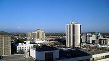
Fresno is located in central California, and is the 5th largest city in the state. Fresno is a midpoint destination between the greater Los Angeles area and the California capital of Sacramento. The city is located in the San Joaquin Valley. Fresno was founded as a direct result of the great California gold rush, with people coming from all over the nation in an attempt to strike it rich. Fresno was incorporated in 1856.
Fresno is a common stopping point for tourists looking to enjoy some of the beautiful national parks situated in the state, such as Kings Canyon National Park, as well as Sequoia and Yosemite National park. Fresno is a college town and has a strong educational heritage, home of Fresno State University.
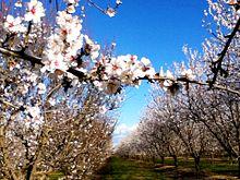
Although Fresno is a large city and urban environment, it stands in the San Joaquin Valley as a center for agriculture and food processing so the city is largely invested in the success of the surrounding agricultural communities. Fresno is also located nearby the Tachi Palace Hotel and Casino, as well as the Chukchansi Gold Resort and Casino, which are two of the largest employers of the city.
In addition to the nearby casinos and national parks, there are a wide variety of cultural attractions which draw people to the city of Fresno, itself, including the Chafee Zoo, the Kearney Mansion Museum, the and Fresno Art Museum. Although home to no major professional sports teams,, the city of Fresno does boast three minor league teams: the Fresno Monsters hockey team, the Fuego soccer club, and the Grizzlies Triple-A baseball team. For fans of music and the performing arts, there are a variety of events year round in Fresno, including the Woodward Shakespeare Festival, the Fresno Philharmonic, and the Grand Opera.
All About Fresno, California Geographic Area
Fresno ( /ËnfrÉoznoÊo/ FREZ-noh) is a city in central California, United States, the county seat of Fresno County. As of 2012, the city's population was 510,365, making it the fifth largest city in California, the largest inland city in California and the 34th largest in the nation. Fresno is in the center of the San Joaquin Valley of Central California, approximately 200 miles (320 km) north of Los Angeles, and 170 miles (270 km) south of the state capital, Sacramento. Metropolitan Fresno has a population of 1,107,416. The name Fresno is the Spanish language word for the ash tree, and an ash leaf is featured on the city's flag.
The original inhabitants of the San Joaquin Valley region were the Yokut people, who engaged in trading with other California tribes of Native Americans including coastal peoples such as the Chumash of the Central California coast, with whom they are thought to have traded plant and animal products.
The County of Fresno was formed in 1856 after the California Gold Rush. It was named for the abundant ash trees lining the San Joaquin River. Fresno is the Spanish word for ash trees. The county was much larger than it is today as part of Tulare County, comprising its current area plus all of what became Madera County and parts of what are now San Benito, Kings, Inyo, and Mono counties.
Millerton, then on the banks of the free-flowing San Joaquin River and close to Fort Miller, became the county seat after becoming a focal point for settlers. Other early county settlements included Firebaugh's Ferry, Scottsburg and Elkhorn Springs.
The San Joaquin River flooded on December 24, 1867, inundating Millerton. Some residents rebuilt, others moved. Flooding also destroyed the town of Scottsburg that winter. Rebuilt on higher ground, Scottsburg was renamed Centerville.
In 1867, Anthony "McQeen" Easterby purchased land bounded by the present Chestnut, Belmont, Clovis and California avenues. Unable to grow wheat for lack of water, he hired Moses J. Church in 1871 to build an irrigation canal. Church then formed the Fresno Canal and Irrigation Company, a predecessor of the Fresno Irrigation District.
In 1872, the Central Pacific Railroad established a station near Easterby's farm for its new Southern Pacific line. Soon there was a store. Around the station and the store grew the town of Fresno Station, later called Fresno. Many Millerton residents, drawn by the convenience of the railroad and worried about flooding, moved to the new community. Fresno became an incorporated city in 1885.
Two years after the station was established, county residents voted to move the county seat from Millerton to Fresno. When the Friant Dam was completed in 1944, the site of Millerton became inundated by the waters of Millerton Lake. In extreme droughts, when the reservoir shrinks, ruins of the original county seat can still be observed.
In the nineteenth century, with so much wooden construction and in the absence of sophisticated firefighting resources, fires often ravaged American frontier towns. The greatest of Fresno's early-day fires, in 1882, destroyed an entire block of the city. Another devastating blaze struck in 1883.
In 1909, Fresno's first and oldest synagogue, Temple Beth Israel, was founded.
The population of Fresno proper soared in the second half of the 20th century. It entered the ranks of the 100 largest United States cities in 1960 census with a population of 134,000. In the 1990 census it moved up to 47th place with 354,000, and in the census of 2000 it achieved 37th place with 428,000, a 21 percent increase during the preceding decade.
The Fresno Municipal Sanitary Landfill was the first modern landfill in the United States, and incorporated several important innovations to waste disposal, including trenching, compacting, and the daily covering of trash with dirt. It was opened in 1937 and closed in 1987. Today, it has the unusual distinction of being a National Historic Landmark as well as a Superfund site.
Before World War II, Fresno had many ethnic neighborhoods, including Little Armenia, German Town, Little Italy, and Chinatown. In 1940, the Census Bureau reported Fresno's population as 94.0% white, 3.3% black and 2.7% Asian. (Incongruously, Chinatown was primarily a Japanese neighborhood and today Japanese-American businesses still remain). During 1942, Pinedale, in what is now North Fresno, was the site of the Pinedale Assembly Center, an interim facility for the relocation of Fresno area Japanese Americans to internment camps. The Fresno Fairgrounds was also utilized as an assembly center.
Row crops and orchards gave way to urban development particularly in the period after World War II; this transition was particularly vividly demonstrated in locations such as the Blackstone Avenue corridor.
In September 1958, Bank of America launched a new product called BankAmericard in Fresno. After a troubled gestation during which its creator resigned, BankAmericard went on to become the first successful credit card; that is, a financial instrument which was usable across a large number of merchants and also allowed cardholders to revolve a balance (earlier financial products could do one or the other but not both). In 1976, BankAmericard was renamed and spun off into a separate company known today as Visa Inc.
The dance style commonly known as popping evolved in Fresno in the 1970s.
In the 1970s, the city was the subject of a song, Walking Into Fresno,' written by Hall Of Fame guitarist Bill Aken and recorded by Bob Gallion of the world-famous "WWVA Jamboree" radio and television show in Wheeling, West Virginia. Aken, adopted by Mexican movie actress Lupe Mayorga, grew up in the neighboring town of Madera and his song chronicled the hardships faced by the migrant farm workers he saw as a child. Aken also made his first TV appearance playing guitar on the old country-western show at The Fresno Barn.
Fictional residents of the town were portrayed in a 1986 comedic mini series titled "Fresno", featuring Carol Burnett, Dabney Coleman, Teri Garr and Charles Grodin, along with numerous other celebrities. The mini series was presented as a parody of the prime time soap operas popular in the 1980s.
In 1995, the Federal Bureau of Investigation's Operation Rezone sting resulted in several prominent Fresno and Clovis politicians being charged in connection with taking bribes in return for rezoning farmland for housing developments. Before the sting brought a halt to it, housing developers could buy farmland cheaply, pay off council members to have it rezoned, and make a large profit building and selling inexpensive housing. Sixteen people were eventually convicted as a result of the sting.
Fresno is at 36 °44 a²52 a³N 119 °46 a²21 a³W / 36.74778 °N 119.7725 °W / 36.74778; -119.7725. as having a total area of 112.3 square miles (291 km2) with 99.69% land covering 112.0 square miles (290 km2), and 0.31% water, 0.4 square miles (1.0 km2).
Fresno's location, very near the geographical center of California, places the city a comfortable distance from several of the major recreation areas and urban centers in the state. Just 60 mi (97 km) south of Yosemite National Park, it is the nearest major city to the park. Likewise, Sierra National Forest is 40 mi (64 km), Kings Canyon National Park is 60 mi (97 km) and Sequoia National Park is 75 mi (121 km).
Because Fresno sits at the junction of Highways 41 and 99 (41 is Yosemite National Park's southern access road, and 99 branches east from Interstate 5 to serve the urban centers of the San Joaquin Valley), the city is a major gateway for Yosemite visitors coming from Los Angeles. The city also serves as an entrance into Sierra National Forest via highway 168, and Sequoia and Kings Canyon National Parks via Highway 180.
Fresno has three large public parks, two in the city limits and one in county land to the southwest. Woodward Park, which features the Shinzen Japanese Gardens, numerous picnic areas and several miles of trails, is in North Fresno and is adjacent to the San Joaquin River Parkway. Roeding Park, near Downtown Fresno, is home to the Fresno Chaffee Zoo, and Rotary Storyland and Playland. Kearney Park is the largest of the Fresno region's park system and is home to historic Kearney Mansion and plays host to the annual Civil War Revisited, the largest reenactment of the Civil War in the west coast of the U.S.
Fresno is marked by a semi-arid climate (Koppen Bsh), with mild, moderately wet winters and hot and dry summers, thus displaying Mediterranean characteristics. December is the coldest month, and averages 53.4 °F (11.9 °C) during the day; July high temperatures average 96.6 °F (35.9 °C), though summer temperatures can occasionally soar to highs of 113 °F (45.0 °C) or more. Summers provide considerable sunshine, with July peaking at 97 percent of the total possible sunlight hours; conversely, January is the lowest with only 46 percent of the daylight time in sunlight because of thick tule fog. However, the year averages 81% of possible sunshine, for a total of 3550 hours. Average annual precipitation is around 11.2 inches (284 mm), which, by definition, would classify the area as a semidesert and very close to a climate where agriculture is only possible through the use of extensive irrigation; rainfall is high in the winter and spring seasons, with the summers typically being very dry. Most of the wind rose direction occurrences derive from the northwest, as winds are driven downward along the axis of the California Central Valley; in December, January and February there is an increased presence of southeastern wind directions in the wind rose statistics. Fresno meteorology was selected in a national U.S. Environmental Protection Agency study for analysis of equilibrium temperature for use of ten-year meteorological data to represent a warm, dry western United States locale.
The highest temperature recorded at the Fresno air terminal was 115 °F (46 °C) on July 23, 2006; the lowest temperature recorded was 17 °F ( na8 °C) on January 10, 1949, and December 23, 1990. Temperatures reach 90 °F (32 °C) or higher on an average of 106.4 days annually and drop to 32 °F (0 °C) or lower on an average of 21.2 days annually. The wettest year at the airport was 1983 with 21.61 inches (549 mm) and the dryest year was 1966 with 6.07 inches (154 mm). The most rainfall in one month was 8.56 inches (217 mm) in January 1969 and the most rainfall in 24 hours was 2.38 inches (60 mm) on March 10, 1995. Measurable precipitation falls on an average of 46 days annually. Snow is a rarity; the heaviest snowfall at the airport was 2.2 inches (56 mm) on January 21, 1962.
Fresno is the larger principal city of the Fresno-Madera CSA, a Combined Statistical Area that includes the Fresno (Fresno County) and Madera (Madera County) metropolitan areas, which had a combined population of 922,516 at the 2000 census.
The 2010 United States Census reported that Fresno had a population of 494,665. The population density was 4,404.5 people per square mile (1,700.6/km ²). The racial makeup of Fresno was 245,306 (49.6%) White, 40,960 (8.3%) African American, 8,525 (1.7%) Native American, 62,528 (12.6%) Asian (3.6% Hmong, 1.7% Indian, 1.2% Filipino, 1.2% Laotian, 1.0% Thai, 0.8% Cambodian, 0.7% Chinese, 0.5% Japanese, 0.4% Vietnamese, 0.2% Korean), 849 (0.2%) Pacific Islander, 111,984 (22.6%) from other races, and 24,513 (5.0%) from two or more races. Hispanic or Latino of any race were 232,055 persons (46.9%). Among the Hispanic population, 42.7% of the total population are Mexican, 0.4% Salvadoran, and 0.4% Puerto Rican. Non-Hispanic Whites were 32.7% of the population in 2010, down from 72.6% in 1970.
The Census reported that 485,798 people (98.2% of the population) lived in households, 4,315 (0.9%) lived in non-institutionalized group quarters, and 4,552 (0.9%) were institutionalized.
There were 158,349 households, out of which 68,511 (43.3%) had children under the age of 18 living in them, 69,284 (43.8%) were opposite-sex married couples living together, 30,547 (19.3%) had a female householder with no husband present, 11,698 (7.4%) had a male householder with no wife present. There were 12,843 (8.1%) unmarried opposite-sex partnerships, and 1,388 (0.9%) same-sex married couples or partnerships. 35,064 households (22.1%) were made up of individuals and 12,344 (7.8%) had someone living alone who was 65 years of age or older. The average household size was 3.07. There were 111,529 families (70.4% of all households); the average family size was 3.62.
The population was spread out with 148,823 people (30.1%) under the age of 18, 62,601 people (12.7%) aged 18 to 24, 135,076 people (27.3%) aged 25 to 44, 102,064 people (20.6%) aged 45 to 64, and 46,101 people (9.3%) who were 65 years of age or older. The median age was 29.3 years. For every 100 females there were 96.7 males. For every 100 females age 18 and over, there were 93.5 males.
There were 171,288 housing units at an average density of 1,525.2 per square mile (588.9/km ²), of which 77,757 (49.1%) were owner-occupied, and 80,592 (50.9%) were occupied by renters. The homeowner vacancy rate was 2.6%; the rental vacancy rate was 7.6%. 235,430 people (47.6% of the population) lived in owner-occupied housing units and 250,368 people (50.6%) lived in rental housing units.
As of the census of 2000, there were 427,652 people, 140,079 households, and 97,915 families residing in the city. The population density was 4,097.9 people per square mile (1,582.2/km ²). There were 149,025 housing units at an average density of 1,427.9 square miles (3,698 km2). The racial makeup of the city was 50.2% White, 8.4% Black or African American, 1.6% Native American, 11.2% Asian (about a third of which is Hmong), 0.1% Pacific Islander, 23.4% from other races, and 5.2% from two or more races. Hispanic or Latino of any race were 39.9% of the population.
There were 140,079 households out of which 40.4% had children under the age of 18 living with them, 46.1% were married couples living together, 17.6% had a female householder with no husband present, and 30.1% were non-families. 23.3% of all households were made up of individuals and 7.9% had someone living alone who was 65 years of age or older. The average household size was 2.99 and the average family size was 3.57.
In the city the age distribution of the population shows 32.9% under the age of 18, 11.8% from 18 to 24, 28.8% from 25 to 44, 17.2% from 45 to 64, and 9.3% who were 65 years of age or older. The median age was 28 years. For every 100 females there were 96.6 males. For every 100 females age 18 and over, there were 93.0 males.
The median income for a household in the city was $32,236, and the median income for a family was $35,892. Males had a median income of $32,279 versus $26,551 for females. The per capita income for the city was $15,010. About 20.5% of families and 26.2% of the population were below the poverty line, including 36.5% of those under age 18 and 10.7% of those age 65 or over.
The population as of July 1, 2007 was estimated to be 470,508 by the US Census Bureau's Population Estimates Program. The Fresno Metropolitan Statistical Area population was estimated at 899,348.
The first Armenians to move to Fresno were the brothers Hagop and Garabed Seropian, who arrived in 1881. Their letters to their home village of Marsovan in the Ottoman Empire brought more immigrants to the San Joaquin Valley, which reminded them so much of home. By 1894 the Armenian population in Fresno was 360, a number which grew rapidly with the onset of the Hamidian Massacres in 1895-96. Many of the immigrants were Protestant converts, the result of heavy missionary activity in Armenia by American Christians seeking converts from the Armenian Church[disambiguation needed]. During and after the genocide even more Armenians came until the restrictions on immigration in 1921 and 1924 brought this to a virtual end. Los Angeles also became a focus of Armenian immigration, and some Armenians from Fresno moved there as well. The number of Armenians in LA surpassed those in Fresno in 1930 ae partly because of the agricultural depression in the valley during the 1920s.
The early immigrants were primarily involved with farming and agriculture, with the ultimate goal almost always that of land ownership. By 1930 Armenians owned 40% of the raisin acreage in Fresno County. They were pioneers in the melon and fig production as well.
From the very beginning, bigotry against Armenians was common, and led many to Anglicize their names. In the 1890s Armenian Protestants were stripped of membership in local churches. Fear of Armenian land ownership caused the passage of laws restricting their rights to freely buy land. This attitude towards the tight knit Armenian community led some to try to assimilate, while having the opposite effect on others. The problem lasted for many decades, finally abating in the 1950s.
After World War II, displaced Soviet Armenians came from Germany, and a natural population flow of Armenians from east to west in the US also contributed to growth.
Today, the number of Armenians in Fresno is thought to number 25-30,000.
Fresno serves as the economic hub of Fresno County and California's San Joaquin Valley. The unincorporated area and rural cities surrounding Fresno remain predominantly tied to large-scale agricultural production. Sony Music Distribution/Sony Computer Entertainment is in Fresno, CA.
According to the City's 2010 Comprehensive Annual Financial Report, the top employers in the city are:
Fresno has a modified strong-mayor form of local government and seven City Council members (Legislative branch) elected for no more than two 4-year terms. The City council and the mayor are nonpartisan, not affiliated with any political party. Alan Autry was first elected in November 2000, reelected on March 2, 2004, and served until January 2009. Ashley Swearengin was sworn in as Mayor on January 6, 2009.
Prior to 1901, Fresno was governed by a board of trustees.
ar Died in office
City council is made up of seven members, elected by district:
Fresno is the county seat of Fresno County. It maintains the main county courthouse on Van Ness in the Fresno County Plaza for criminal and some civil court cases.
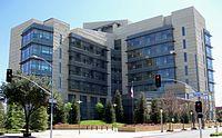
The United States District Court, Eastern District of California, has one of its six divisions based in the Robert E. Coyle Courthouse. The new courthouse replaced the B.F. Sisk Federal Building in 2006 because it did not have enough space for the growing Fresno Division. After extensive renovation, the building reopened in November 2010 as the B.F. Sisk Courthouse serving the Fresno County Superior Court.
Fresno is also the seat of the Fifth Appellate District of the State of California Court of Appeal where a new courthouse was built in the old Armenian Town section of downtown Fresno in 2007 across from the Fresno Convention Center. The Fifth District Court of Appeal Courthouse is named after former Senator and Associate Justice of the Fifth District, George N. Zenovich.
According to Fresno County Registrar of Voters, the majority of registered voters in both the city and county of Fresno are registered to the Democratic Party. According to the county registrar's official final reportU.S. President Barack Obama carried the county 49.99%.
The citizens of Fresno are represented in the California State Senate by Tom Berryhill (R) and Michael Rubio (D) and in the California State Assembly by Linda Halderman (R) and Henry Perea (D). The citizens of Fresno are represented in the United States Congress by Jeff Denham (R) in California's 19th congressional district, Jim Costa (D) in California's 20th congressional district and Devin Nunes (R) in California's 21st congressional district.
Through the 1990s, downtown was one of the last remaining examples of untouched architecture in California, but it has recently been subjected to a mixed revitalization effort. While many of the buildings that were once abandoned for many years have been remodeled, many have been demolished or are under threat of being demolished to be replaced with new structures. Recently added new structures such as Grizzlies Stadium, now Chukchansi Park and the Federal Courthouse, and plans to eventually erect new high-rise buildings, threaten the unique and increasingly rare twentieth century architecture.
A victim of this redevelopment was the Vagabond Hotel, unique in its relevance in popular culture. The Vagabond, which had a pool that was an important location in modern skateboarding history and a prime example of mid-century modern googie "roadside" architecture, was demolished in 2004 and replaced by concrete commercial lots and lofts in 2006. The old Army Induction Center, which was used during the Vietnam War, was also recently destroyed in the next development project on H St and Amador.
The historic Fulton Mall and Chinatown are two downtown areas which still retain an exceptional amount of historic buildings and architecture of contextual, associative and memorial value in comparison with other cities of California and the Western United States, and are being considered for preservation as historic districts.
The neighborhood of Sunnyside is on Fresno's far southeast side, bounded by Chestnut Avenue to the West. Its major thoroughfares are Kings Canyon Avenue and Clovis Avenue. Although parts of Sunnyside are within the City of Fresno, much of the neighborhood is a "county island" within Fresno County. Largely developed in the 1950s through the 1970s, it has recently experienced a surge in new home construction. It is also the home of the Sunnyside Country Club, which maintains a golf course designed by William Bell.
First started as a development known as Forkner-Giffen Fig Garden Estates #1 the now historic community set among mature trees of Old Fig Garden has long been one of Fresno's most prestigious neighborhoods. Fig Garden is an area of approximately 6 sq mi (16 km2), once on the northern fringe of Fresno, but the city has since incorporated all of the surrounding land, making Fig Garden a county "island." The city's annual "Christmas Tree Lane" is found on a section of Van Ness Boulevard during the holiday season.
Christmas Tree Lane is on Van Ness Boulevard in between Shields Avenue and Shaw Avenue and runs through Old Fig Garden. It was started in 1920 when a single tree in the front yard of one of the houses on Van Ness Boulevard was decorated with lights to honor their teenage son who was killed by an accident at the family home. After that, more and more houses began decorating their front yard trees and soon enough Christmas Tree Lane was born. In 1941 the lane could not light the trees due to wartime restrictions and another time in 1973 due to an energy crisis. December 2011 marks the 89th anniversary for Christmas Tree Lane which makes it one of the longest running Christmas traditions in the country. Christmas Tree Lane is so well known that it made the Washington Post. Over 100,000 people make the effort to either walk or drive down Christmas Tree Lane every year. Many homes on Christmas Tree Lane hold parties at their homes in order to see the annual parade on the opening night. The Lane also has two designated Walk-Nights, closing the street to traffic. Many neighborhoods in Fresno have started their own holiday light lanes, but to this day Christmas Tree Lane is still the one that people line up to see.
The popular neighborhood known as the Tower District is centered around the historic Tower Theatre, which is included on the National List of Historic Places. The theater was built in 1939 and is at Olive and Wishon Avenues in the heart of the Tower District. (The name of the theater refers to a well-known landmark water tower which is actually in another nearby area). The Tower District neighborhood is just north of downtown Fresno proper, and one-half mile south of Fresno City College. Although the neighborhood was known as a residential area prior, the early commercial establishments of the Tower District began with small shops and services that flocked to the area shortly after World War II. The character of small local businesses largely remains today, despite the presence of national chain Starbucks. To some extent, the businesses of the Tower District were developed due to the proximity of the original Fresno Normal School, (later renamed California State University at Fresno). In 1916 the college moved to what is now the site of Fresno City College one-half mile north of the Tower District.
This vibrant and culturally diverse area of retail businesses and residences experienced a renewal after a significant decline in the late 1960s and 1970s. After decades of neglect and suburban flight, the neighborhood revival followed the re-opening of the Tower Theater in the late 1970s, which at that time showed second and third run movies, along with classic films. Roger Rocka's Dinner Theater & Good Company Players also opened nearby in 1978, at Olive and Wishon Avenues. Fresno native Audra McDonald performed in the leading roles of Evita and The Wiz at the theater while she was a high school student. Ms. McDonald subsequently became a leading performer on Broadway in New York City and a Tony award winning actress. Also in the Tower District is Good Company Players' 2nd Space Theatre.
The Tower District has become a hub for community events such as Jamaica My Weekend, Mardi Gras in February, Gay Pride Parade, Car Shows, A Taste of The Tower, Halloween in the Tower, and the opened Farmer's Market on the North-West Corner of Olive and Van Ness.
The neighborhood features some notable restaurants, live Theatre and nightclubs, as well as several independent shops and bookstores, currently operating on or near Olive Avenue, and all within a few hundred feet of each other. Since renewal, the Tower District has become an attractive area for restaurant and other local businesses. Today, the Tower District is also known as the center of Fresno's LGBT and Hipster Communities.; Additionally, Tower District is also known as the center of Fresno's local punk/goth/deathrock and heavy metal community.
The area is also known for its early twentieth century homes, many of which have been restored in recent decades. The area includes many California Bungalow and American Craftsman style homes, Spanish Colonial Revival Style architecture, Mediterranean Revival Style architecture, Mission Revival Style architecture, and many Storybook houses designed by Fresno architects, Hilliard, Taylor & Wheeler. The residential architecture of the Tower District contrasts with the newer areas of tract homes urban sprawl in north and east areas of Fresno.
Homes from the early 20th century line this boulevard in the heart of the historic Alta Vista Tract. The section of Huntington Boulevard between First Street on the west to Cedar Avenue on the east is the home to many large, stately homes. The original development of this area began circa 1910, on 190 acres of what had been an alfalfa field. The Alta Vista Tract, as the land would become known, was mapped by William Stranahan for the Pacific Improvement Corporation, and was officially platted in 1911. The tract's boundaries were Balch Avenue on the south, Cedar Avenue on the east, the rear property line of Platt Avenue (east of Sixth Street) and Platt Avenue (west of Sixth Street) on the north, and First Street on the west. The subdivision was annexed to the City in January 1912, in an election that was the first in which women voted in the community. At the time of its admission to the City, the Alta Vista Tract was uninhabited but landscaped, although the trees had to be watered by tank wagon. In 1914 developers Billings & Meyering acquired the tract, completed street development, provided the last of the necessary municipal improvements including water service, and began marketing the property with fervor. A mere half decade later the tract had 267 homes. This rapid development was no doubt hastened by the Fresno Traction Company right-of-way along Huntington Boulevard, which provided streetcar connections between downtown and the County Hospital.
The surrounding streets, Kerckhoff and Balch Avenues (which are part of the original Alta Vista tract), have homes from the Arts and Crafts era which, like the downtown, are being renovated and brought back to their historic roots. During Christmas, the homes along the boulevard are adorned with lights and decorations. The nation's tallest living Christmas Tree, at Huntington and 6th Street, is the highlight of the event.
Huntington Boulevard has been referred to as Fresno's "anti-gated community".
North of Shaw Avenue, Van Ness continues as the Van Ness Extension, between Marks Avenue and West Avenue. Van Ness Extension is considered the most prestigious neighborhood in the city, and boasts some of Fresno's most elaborate homes and most affluent citizens.
Residents include many notable doctors, business owners, entrepreneurs, and stock traders.
The "West Side" of Fresno, also often called "Southwest Fresno", or "Wacc side" is one of the oldest neighborhoods in the city. The neighborhood lies southwest of the 99 freeway (which divides it from Downtown Fresno), west of the 41 freeway and south of Nielsen Ave (or the newly-constructed 180 Freeway), and extends to the city limits to the west and south. The neighborhood is traditionally considered to be the center of Fresno's African-American community. It is culturally diverse and also includes significant Mexican-American and Asian-American (principally Hmong or Laotian) populations.
The neighborhood includes Kearney Boulevard, named after early 20th century entrepreneur and millionaire M. Theo Kearney, which extends from Fresno Street in Southwest Fresno about 20 mi (32 km) west to Kerman, California. A small, two-lane rural road for most of its length, Kearney Boulevard is lined with tall palm trees. The roughly half-mile stretch of Kearney Boulevard between Fresno Street and Thorne Ave was at one time the preferred neighborhood for Fresno's elite African-American families. Another section, Brookhaven, on the southern edge of the West Side south of Jensen and west of Elm, was given the name by the Fresno City Council in an effort to revitalize the neighborhood's image. The isolated subdivision was for years known as the "Dogg Pound" in reference to a local gang, and as of late 2008 was still known for high levels of violent crime.
While many homes in the neighborhood date back to the 1930s or before, the neighborhood is also home to several public housing developments built between the 1960s and 1990s by the Fresno Housing Authority. The US Department of Housing and Urban Development has also built small subdivisions of single-family homes in the area for purchase by low-income working families. There have been numerous attempts to revitalize the neighborhood, including the construction of a modern shopping center on the corner of Fresno and B streets, an aborted attempt to build luxury homes and a golf course on the western edge of the neighborhood, and some new section 8 apartments have been built along Church Ave west of Elm St. Cargill Meat Solutions and Foster Farms both have large processing facilities in the neighborhood, and the stench from these (and other small industrial facilities) has long plagued area residents. The Fresno Chandler Executive Airport is also on the West Side. Due to its position on the edge of the city and years of neglect by developers, is not a true "inner-city" neighborhood, and there are many vacant lots, strawberry fields and vineyards throughout the neighborhood. The neighborhood has very little retail activity, aside from the area near Fresno Street and State Route 99 Freeway (Kearney Palm Shopping Center, built in the late 1990s) and small corner markets scattered throughout.
In the north eastern part of Fresno, Woodward Park was founded by the late Ralph Woodward, a long-time Fresno resident. He bequeathed a major portion of his estate in 1968 to provide a regional park and bird sanctuary in Northeast Fresno. The park lies on the South bank of the San Joaquin River between Highway 41 and Friant Road. The initial 235 acres (0.95 km2), combined with additional acres acquired later by the City, brings the park to an amazing 300 acres (1.2 km2). Now packed with amenities, Woodward Park is the only Regional Park of its size in the Central Valley. The Southeast corner of the park harbors numerous bird species offering bird enthusiasts an excellent opportunity for viewing. The park has a multi-use amphitheatre that seats up to 2,500 people, authentic Japanese Garden, fenced dog park, two-mile (3 km) equestrian trail, exercise par course, three children's playgrounds, a lake, 3 small ponds, 7 picnic areas and five miles (8 km) of multipurpose trails that are part of the San Joaquin River Parkway's Lewis S. Eaton Trail. When complete, the Lewis S. Eaton trail system will cover 22 miles (35 km) between Highway 99 and Friant Dam. The park's numerous picnic tables make for a great picnic destination and a convenient escape from city life. The park's amphetheatre was renovated in 2010, and has hosted performances by acts such as Deftones, Tech N9ne, and Sevendust as well as numerous others. The park is open April through October, 6am to 10pm and November through March, 6am to 7pm.
Formed in 1946, Sierra Sky Park Airport is a residential airport community born of a unique agreement in transportation law to allow personal aircraft and automobiles to share certain roads. Sierra Sky Park was the first aviation community to be built and there are now numerous such communities across the United States and around the world. Developer William Smilie created the nation's first planned aviation community. Still in operation today, the public use airport provides a unique neighborhood which spawned interest and similar communities nationwide.

Fresno-based sports organizations include:
88.1 KFCF is Fresno's Pacifica station, and one of Fresno's few non-commercial, non-corporate radio stations.
KMJ was Fresno's first radio station; it began broadcasting in 1922. Over the years its powerful 50,000-watt signal could clearly be heard throughout much of California. Here are the Fresno radio stations currently broadcasting:
To avoid interference with existing VHF television stations in the San Francisco Bay Area and those planned for Chico, Sacramento, Salinas, and Stockton, the Federal Communications Commission decided that Fresno would only have UHF television stations. The very first Fresno television station to begin broadcasting was KMJ-TV, now known as KSEE, Channel 24, which began broadcasting on June 1, 1953. Here are the Fresno television stations currently on the air:
Fresno has several sister cities, as designated by Sister Cities International, Inc. (SCI).
Fresno is served by State Route 99, the main north/south freeway that connects the major population centers of the California Central Valley. State Route 168, the Sierra Freeway, heads east to the city of Clovis and Huntington Lake. State Route 41 (Yosemite Freeway/Eisenhower Freeway) comes into Fresno from Atascadero in the south, and then heads north to Yosemite. State Route 180 (Kings Canyon Freeway) comes from the west via Mendota, and from the east in Kings Canyon National Park going towards the city of Reedley.
Fresno is the largest U.S. city not directly linked to an Interstate highway. When the Interstate Highway System was created in the 1950s, the decision was made to build what is now Interstate 5 on the west side of the Central Valley, and thus bypass many of the population centers in the region, instead of upgrading what is now State Route 99. Due to rapidly raising population and traffic in cities along SR 99, as well as the desirability of Federal funding, much discussion has been made to upgrade it to interstate standards and eventually incorporate it into the interstate system, most likely as Interstate 9. Major improvements to signage, lane width, median separation, vertical clearance, and other concerns are currently underway.
Fresno Yosemite International Airport (FAT), formerly known as Fresno Air Terminal, provides regularly scheduled commercial airline service. The airport serves an estimated 1.3 million passengers annually to domestic and two international destinations.
Fresno Chandler Executive Airport (FCH) is 2 mi (3.2 km) southwest of Downtown Fresno. Built in the 1920s by the Works Projects Administration, it is one of the oldest operational airports in California. The airport currently serves as a general aviation airport.
Sierra Sky Park Airport in Northwest Fresno is a privately owned airport, but is open to the public. The airport was America's first aviation community. Extra-wide streets surrounding the airport allow for residents of the community to land, taxi down extra-wide avenues, and park in the driveway at home.
Passenger rail service is provided by Amtrak San Joaquins. The main passenger rail station is the recently renovated historic Santa Fe Railroad Depot in Downtown Fresno. The Bakersfield-Stockton mainlines of the Burlington Northern Santa Fe Railway and Union Pacific Railroad railroads cross in Fresno, and both railroads maintain railyards within the city; the San Joaquin Valley Railroad also operates former Southern Pacific branchlines heading west and south out of the city. The city of Fresno is planned to serve the future California High Speed Rail.
Public transit is provided by the Fresno Area Express. It consists entirely on buses serving the greater Fresno metropolitan area. It has many FAX buses, and the bus is commonly used. Intercity and long-distance bus service is provided by Greyhound and Orange Belt Stages.
The city once provided trolley service during the late 19th and early 20th century. Known as the Fresno City Railway Company and later the Fresno Traction Company, the service operated horse-drawn streetcars from 1887 to 1901. Electric streetcars were introduced in 1903. The electric streetcars were used until 1939.
A 2011 study by Walk Score ranked Fresno 26th most walkable of fifty largest U.S. cities.
US Army Reserve, 63rd Regional Support Command All at the US Army Reserve Center at the Fresno Chandler Executive Airport
Army Maintenance Support Activity 14
729 Training Camp Company
924 Training Camp Detachment
US Marine Corps Forces Reserve, Marine Wing Support Squadron 473 Detachment Alpha formerly at The Fresno Yosemite international Airport. The unit is now based out of Lemoore Naval Air Station in Lemoore, California, about 30 miles outside Fresno.
Naval Air Station Lemoore, the Navy's west coast Master Jet Base is 30 miles (48 km) south of downtown Fresno.
United States Naval Sea Cadet Corps, Fresno Battalion Navy Operational Support Center
Navy League Cadet Corps, Training Ship Fresno Navy Operational Support Center at The Fresno Armed Forces Reserve Center adjacent to Hammer Army Air Field Armory
Civil Air Patrol, Fresno Composite Squadron 112 At the Army National Guard Armory on the Fresno Fair grounds, hanger at Fresno Yosemite international Airport.
40th Aviation Brigade, 40th Infantry Division At Hammer Army Air Field Armory
Echo Company, 79th Brigade Support Battalion, 79th Infantry Brigade Combat Team, 40th Infantry Division
1106th Theater Aviation Maintenance Sustainment Group, 1106th Aviation Classification Repair Depot At the Aviation Classification Repair Depot on the Fresno Yosemite International airport
Detachment 1, 649th MP Company, 49th Military Police Brigade
144th Fighter Wing at the California Air National Guard Base at Fresno Yosemite International Airport
40th Combat Aviation Brigade (CAB), 100th Troop Command Support Brigade At The Fresno Armed Forces Reserve Center adjacent to Hammer Army Air Field Armory
The City of Fresno is home to a number of nonprofits that serve the community, and/or contribute to the local economy by providing employment opportunities. Nonprofits based in Fresno include:

Word Count: 7283